Wicomico, Worcester, Somerset, Accomack, Northampton and Dorchester counties are on the watch list. Locally heavy rainfall and damaging winds are possible, particularly from 8 a.m. until 2 p.m.
Showing posts with label weather. Show all posts
Showing posts with label weather. Show all posts
Wednesday, December 1, 2010
TORNADO WATCH- HEAVY RAINFALL- HIGH WINDS
The National Weather Service has issued a tornado watch for the Lower Shore through 10 a.m., as well as a watch for potentially violent thunderstorms.
Thursday, September 30, 2010
SEVERE WEATHER ALERT
SEVERE: COASTAL FLOOD WARNING KENT COUNTY - FLOOD WARNING KENT, SUSSEX, QUEEN ANNE'S, CAROLINE, AND TALBOT COUNTIES
THE NATIONAL WEATHER SERVICE HAS ISSUED A COASTAL FLOOD WARNING UNTIL 7:00 PM FOR KENT COUNTY, DE. A FLOOD WARNING HAS BEEN ISSUED UNTIL 7:45 PM FOR KENT, SUSSEX, QUEEN ANNE'S, CAROLINE, AND TALBOT COUNTIES.
A TORNADO WATCH IS IN EFFECT FOR KENT, SUSSEX, QUEEN ANNE'S, TALBOT, AND CAROLINE COUNTIES UNTIL 7:00 PM. A FLASH FLOOD WATCH HAS BEEN ISSUED FOR DORCHESTER, SOMERSET, WICOMICO, WORCESTER, AND ACCOMACK COUNTIES UNTIL 9 PM.
A WIND ADVISORY IS IN EFFECT FOR SUSSEX COUNTY AND THE DELAWARE BEACHES UNTIL MIDNIGHT; FOR KENT, QUEEN ANNES, TALBOT, AND CAROLINE, ACCOMACK, AND THE MARYLAND BEACHES UNTIL 8 PM.
A COASTAL FLOOD ADVISORY IS IN EFFECT FOR DORCHESTER, SOMERSET, AND WICOMICO COUNTIES FROM 4 PM UNTIL 2 AM FRIDAY.
www.wboc.com
Wind Restrictions At Bay Bridge Tunnel
Wind restrictions on the Chesapeake Bay Bridge Tunnel have been lifted.
 As of 6 AM there were Level 2 wind restrictions posted at the Chesapeake Bay Bridge Tunnel.
The following types of vehicles are not allowed to cross:
- motorcycles
- large pick-up campers
- camper trailers
- house trailers
- anything being towed
- vehicles with exterior cargo or anything being towed
- empty tractor-trailers, not including empty tanker trucks
- small, six-wheel trucks
Tractor trailers must gross 30,000 pounds of payload in addition to the rigs weight, according to the facilitys Web site. Six-wheel trucks must gross 15,000 pounds of payload in addition to the weight of the rig.
Tractors without trailers will be allowed to cross the span, the site says.
http://www.shoredailynews.com/
Wednesday, September 29, 2010
Flash Flood Watch In Effect For Eastern Shore of Md. and Va.
 A Flash Flood Watch has been issued to for Onancock, VA by the National Weather Service.
The flash flood watch will be in effect from this evening through Thursday evening and will be in effect for portions of the Lower Eastern Shore of Maryland and Virginia.
The following counties are under the watch: Worcester County, Somerset, Wicomico, Accomack and Northampton.
Showers will overspread the area from the south by this afternoon, possibly becoming heavy at times by the early evening. Rain will increase in intensity overnight with periods of heavy rain continuing into Thursday as a Subtropical low pressure system tracks along the Florida peninsula today and lifts north across the Mid-Atlantic Coastal plain region on Thursday.
Rainfall amounts from this system are expected to range between 3 and 4 inches over the watch area. However there is potential for higher amounts in local areas, especially in areas that receive thunderstorms.
A flash flood watch means that conditions may develop that lead to flash flooding. Flash flooding is a very dangerous situation. People living in areas that are prone to flash flooding should monitor later forecasts and be prepared to take action should flash flood warnings be issued. Motorists tonight and Thursday should be aware of the possibility of flooded roads.
www.shoredailynews.com
Wednesday, September 8, 2010
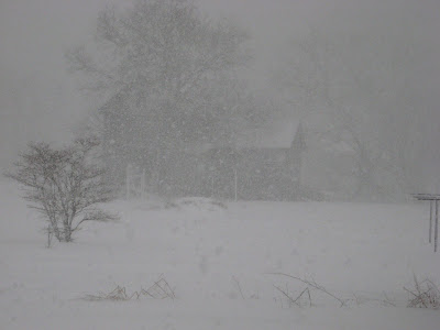
An Interesting 2011 Old Farmer's Almanac Prediction
 The 2011 Old Farmer's Almanac has predicted a cold and snowy winter for the Eastern Shore, according to its Winter Weather Map. The Almanac predicts snowfall will be above normal in the mid-Atlantic states from November through March.
According to its regional forecast, the coldest periods for our area along the Atlantic Corridor will be in December, January and mid-February. The Almanac predicts the most snowfall in January and February.
The Old Farmer's Almanac uses historical weather data to predict data for upcoming years.
 Maybe we should start preparing now..................
www.shoredailynews.com
Friday, September 3, 2010
Hurricanes Of Maryland Through The Years
While Hurricane Earl is still on our minds go to the link below to see if you remember any of the past hurricanes that have passed through Maryland. Many of them are of Ocean City, Maryland.
Hurricanes that blew through Maryland through the years - baltimoresun.com

Hurricane Esther(George Cook, Baltimore Sun / September 21, 1961)Esther pushed high tides into some of the streets of Ocean City. |
www.baltimoresun.com
Wednesday, September 1, 2010
Ships In Norfolk Ready To Evade Hurricane Earl
 NORFOLK, Va. (AP) — The Navy says its ships in the Hampton Roads area are ready to head to sea to evade Hurricane Earl if needed.
The Navy said Tuesday that other operations in the area are normal. But preparations are being made for Earl, including placing sandbags in low-lying areas and removing debris from drainage areas.
Navy personnel have been advised to prepare for evacuation in the event one is necessary.
The National Hurricane Center says Earl has strengthened into a Category 4 hurricane with winds near 135 mph (215 kph) as it moves away from the Virgin Islands.
Earl is on a path that could brush the coast of the U.S. later in the week, though it's too early to tell exactly where it will go.
Tuesday, August 31, 2010
Hurricane Earl May Effect The Shore
 The East Coast is casting an eye toward Hurricane Earl.
The category 4 hurricane is expected to have some effect on our weather late Thursday or early Friday.
Earl should weaken to a strong category 2 storm as it reaches these latitudes. Weather forecasters currently think Earl will pass a couple of hundred miles off the coast but the development of a high pressure system out in the Atlantic and whether a trough in the mid west will make it here before Earl arrives will determine whether Earl will move off without affecting our weather dramatically, or move closer and brush us with tropical storm winds, rain and wind. At the very least, Earl promises to disrupt seaside activities bringing in high tides, heavy surf and strong rip currents into the weekend.
Eastern Shore residents should have plans finalized in case evacuation of low lying areas and mobile homes is recommended by the Dept. of Emergency Services. Preparations to secure or remove smaller boats from the water should be ready in case a Hurricane or Tropical Storm watch is issued for this area.
Plans should be made to evacuate to higher ground if necessary or to a more substantial structure if you live in a mobile home.
You should make arrangements for your own safety and that of your pets.
Everyone should be putting together an emergency kit which should include some canned food or packaged food that doesnt require refrigeration, three gallons of fresh water per person, a radio and flashlights with spare batteries, a several day supply of any medication you might need, some cash important papers including insurance cards and other papers you might need and pet food if necessary.
You should be prepared in case electric service is interrupted for an extended period.
Thursday, August 19, 2010
The Heavens Opened And It Finally Rained !!
The Eastern Shore contiues to get much needed rain as rain and thunderstorms were in the area throughout the day on Wednesday. Downpours covered the area Wednesday morning causing traffic on main roads to slow.
Roadways and yards were partially flooded from the rainfall which exceeded 2 inches. Weather experts predict storms and rain to continue in the area through Thursday with temperatures in upper 80's.
AHHHHH.... Life is good..............
Roadways and yards were partially flooded from the rainfall which exceeded 2 inches. Weather experts predict storms and rain to continue in the area through Thursday with temperatures in upper 80's.
AHHHHH.... Life is good..............
Wednesday, August 4, 2010
From the National Weather Service
SEVERE WEATHER ALERT: HEAT ADVISORY / SEVERE THUNDERSTORM WATCH
THE NATIONAL WEATHER SERVICE HAS ISSUED A SEVERE THUNDERSTORM WATCH FOR ALL DELMARVA COUNTIES UNTIL 1 AM THURSDAY. THUNDERSTORMS CROSSING THE PENINSULA WILL CONTAIN POTENTIALLY DAMAGING WINDS AND LIGHTNING. THE NATIONAL WEATHER SERVICE HAS ALSO ISSUED A HEAT ADVISORY FROM 11 AM TO 7 PM THURSDAY FOR DORCHESTER, SOMERSET, WICOMICO, WORCESTER, AND ACCOMACK COUNTIES; AND FROM 11 AM TO 10 PM THURSDAY FOR KENT, SUSSEX, QUEEN ANNE'S, TALBOT, AND CAROLINE COUNTIES...A HEAT ADVISORY MEANS THAT A PERIOD OF HOT TEMPERATURES IS EXPECTED...THE HEAT INDEX IS EXPECTED TO REACH THE UPPER 90S TO LOWER 100S...THIS COMBINATION OF HEAT AND HUMIDITY WILL CREATE A SITUATION IN WHICH HEAT ILLNESSES ARE POSSIBLE...DRINK PLENTY OF FLUIDS, STAY IN AN AIR-CONDITIONED ROOM, AND STAY OUT OF THE SUN IF POSSIBLE.
Monday, July 26, 2010
Md. Fatality On Personal Watercraft During Storm
If you have ever ventured onto the open spaces of the bay, or any mass of water, you know that sometimes no matter how frequent you check the skies conditions can change in a matter of seconds! There can actually be NO warning. My guess is that this was exactly what happened.
 ANNAPOLIS — Officials in Maryland say a 63-year-old man using a personal watercraft died after encountering severe thunderstorms while riding Sunday evening.
 ANNAPOLIS — Officials in Maryland say a 63-year-old man using a personal watercraft died after encountering severe thunderstorms while riding Sunday evening.
Maryland Natural Resources Police said Monday it is investigating the death of Warren Douglas Smith who was riding a personal watercraft one-half mile south of the Bay Bridge in the Chesapeake Bay.
Smith and a friend were trying to get back to land when they encountered the storm, which officials said produced winds estimated at 60 miles per hour, waves five to six feet in height and strong lightning. The storm knocked Smith's friend off his watercraft and when he got back up he saw Smith laying face down in the water. Smith was transported to a hospital where he was pronounced dead.
Friday, July 16, 2010
Small Earthquake Shakes D.C. Area
 USGS Says 3.6 Magnitude Quake Centered Near Suburb of Gaithersburg, Maryland; No Immediate Reports of Damage
A minor, 3.6 magnitude earthquake shook Washington D.C.-area residents out of bed early Friday morning - a rare occurrence for the nation's east coast dwellers.
CBS News staff in the Maryland suburb of Bethesda and the Virginia suburb of Arlington both reported feeling the tremor, which the U.S. Geological Survey said was centered 20 miles northwest of the nation's capital in Gaithersburg, Maryland.
There were no immediate reports of damage or injuries, only surprised people being woken up at just past 5 a.m. Eastern time.
Lucille Baur, public information officer for the Montgomery County Police Department in Maryland, said the department received a lot of calls from people wondering what had happened.
Baur said her husband woke up when the quake struck.
"At first he thought it was a big truck going through," she said. "He felt the house shake and the windows rattle a little bit."
Sunday, June 27, 2010
Hurricane Preparedness Program Is Offered
Maybe it's not too late to register!
 Preparing for an impending hurricane or other disaster is hard enough. But when you¡re caring for someone who is seriously ill, disaster preparation is even more difficult. The Caregiver Coalition, a partnership between Hospice and Palliative Care of the Eastern Shore, Eastern Shore Area Agency on Aging and Community Action Agency, Riverside Shore Memorial Hospital, ESCC, and the Alzheimer¡s Association of Southeastern Virginia are pleased to present this workshop:
Hope Is Not a Plan!
Tips for Caregivers on Preparing for the Hurricane Season
Monday, June 28, 2010, 12:00 pm ¡V 3:30 pm, Onancock Hospice Building, 165 Market St, Suite 3
Be sure to attend this informative workshop and learn about:
Making a Family Disaster Plan
Checklists and Supply Kits
Documents that Should Be Protected
Having a Place to Go
Special Preparations for Yourself and Your loved Ones
Post-disaster Scams
Facing a Hurricane, Experiences of a Katrina Victim
Post-Hurricane/Disaster ¡V How to Handle the Losses
There is no cost to attend; lunch and materials are provided. Transportation can also be arranged with advanced notice. This workshop is open to everyone in the community, but pre-registration is required. To register, call Brandon at 757-787-3310 x113.
Preparing for an impending hurricane or other disaster is hard enough. But when you¡re caring for someone who is seriously ill, disaster preparation is even more difficult. The Caregiver Coalition, a partnership between Hospice and Palliative Care of the Eastern Shore, Eastern Shore Area Agency on Aging and Community Action Agency, Riverside Shore Memorial Hospital, ESCC, and the Alzheimer¡s Association of Southeastern Virginia are pleased to present this workshop:Hope Is Not a Plan!
Tips for Caregivers on Preparing for the Hurricane Season
Monday, June 28, 2010, 12:00 pm ¡V 3:30 pm, Onancock Hospice Building, 165 Market St, Suite 3
Be sure to attend this informative workshop and learn about:
Making a Family Disaster Plan
Checklists and Supply Kits
Documents that Should Be Protected
Having a Place to Go
Special Preparations for Yourself and Your loved Ones
Post-disaster Scams
Facing a Hurricane, Experiences of a Katrina Victim
Post-Hurricane/Disaster ¡V How to Handle the Losses
There is no cost to attend; lunch and materials are provided. Transportation can also be arranged with advanced notice. This workshop is open to everyone in the community, but pre-registration is required. To register, call Brandon at 757-787-3310 x113.
Saturday, June 26, 2010
Lunar Eclipse in Central and Western United States

(June 26) -- Early risers in the central and western United States were greeted with a celestial treat this morning, as the moon passed through the earth's shadow, causing a lunar eclipse.
Over half the moon was darkened this morning, starting at around 6:17 am eastern time, according to the BBC. The moon also appeared unusually large, thanks to a little-understood phenomenon called the Moon illusion.
When this occurs, low-hanging Moons appear "unnaturally large when they beam through trees, buildings and other foreground objects", according to the NASA website. The reasons for this are not clear.
"The lunar eclipse was beautiful as it set over the distant Owyhee Mountains on Saturday morning!" Jared Aicher of Boise, Idaho told Spaceweather.com. "The light was changing rapidly, and show was magnificent."
The next lunar eclipse is due in December.
Today's eclipse was also visible over large parts of Asia. Over 3,000 people gathered at the Singapore Science Centre's Observatory to catch a glimpse of the event.
"A partial lunar eclipse is a beautiful thing," Dr Tony Phillips said on the NASA website.
Thursday, June 24, 2010
Another HOT Day-- Maybe Even HOTTER
The Accomac Office of the Virginia Department of Health would like to remind everyone as temperatures continue to remain extremely high, the Eastern Shore Health District advises citizens to protect themselves by keeping cool and using common sense.

It is important to drink plenty of fluids, wear light weight, light colored, loose fitting clothing, put on sunscreen when outdoors, limit outdoor activities to morning and evening hours, rest often, stay cool indoors if possible, check on family members and neighbors and to monitor yourself and others for heat exhaustion.
Heat exhaustion is a mild form of heat-related illness that can develop after several days of exposure to high temperatures and inadequate or unbalanced replacement of fluids. Those most prone to heat exhaustion are elderly people, people with high blood pressure and people working or exercising in a hot environment. Warning signs of heat exhaustion include heavy sweating, paleness, muscle cramps, tiredness, weakness, dizziness, headache, nausea or vomiting, fainting, cool or moist skin, pulse rate that is fast and weak and breathing that is fast and shallow.
If heat exhaustion is untreated, it may progress to a heat stroke. Seek medical attention immediately if symptoms are severe or the victim has heart problems or high blood pressure. Otherwise, help the victim to cool off and seek medical attention if symptoms worsen or last longer than one hour.

It is important to drink plenty of fluids, wear light weight, light colored, loose fitting clothing, put on sunscreen when outdoors, limit outdoor activities to morning and evening hours, rest often, stay cool indoors if possible, check on family members and neighbors and to monitor yourself and others for heat exhaustion.
Heat exhaustion is a mild form of heat-related illness that can develop after several days of exposure to high temperatures and inadequate or unbalanced replacement of fluids. Those most prone to heat exhaustion are elderly people, people with high blood pressure and people working or exercising in a hot environment.
Warning signs of heat exhaustion include heavy sweating, paleness, muscle cramps, tiredness, weakness, dizziness, headache, nausea or vomiting, fainting, cool or moist skin, pulse rate that is fast and weak and breathing that is fast and shallow.If heat exhaustion is untreated, it may progress to a heat stroke. Seek medical attention immediately if symptoms are severe or the victim has heart problems or high blood pressure. Otherwise, help the victim to cool off and seek medical attention if symptoms worsen or last longer than one hour.
And PLEASE DON'T FORGET-- As you go about your day, trying to keep cool in these record breaking temperatures, remember kindly your animals that are outside. They NEED to be cool also! DON'T leave them unattended in your vehicle for any amount of time.
An empty soda bottle filled with water and frozen makes a wonderful toy for dogs.
Think about it: Would you want to sit in a hot car with the windows rolled up and wait???
Monday, June 21, 2010

Wednesday, May 26, 2010
Don't Forget To Buy Your Tax Free Hurricane Items

HAMPTON ROADS, Va. (WAVY) - Forecasters are expecting the Atlantic Hurricane season to be busier than normal, as the 2010 season approaches and a low pressure cell off the coast has caught the attention of Super Doppler 10 meteorologists.
It's not supposed to bother us, but it's nature's way of reminding everybody of the season to come.
A low pressure cell lingering off the Virginia and Carolina coasts has already generated rough surf along the beaches. Forecasters do not expect any real trouble from this one, but they continue to monitor its movement.
But preparing for an approaching storm or hurricane involves a lot more than just keeping an eye on the weather.
"Every family should have an emergency preparedness kit," said Wayne Lousteau, a manager at Home Depot.
Lousteau says there are a number of relatively inexpensive items you should have to meet basic necessities when riding out a storm.
"You want to make sure that you have light available to you, that you have water and food available to you and that you have a source of information," he said.
It's information that could save your life.
"What I'm holding...is a radio that will always have access to the NOAA Weather Radio Stations and can be provided power via two methods," Lousteau said.
Standard batteries, or the hand crank, generates electricity for the radio. Lousteau also says you should make sure you have plenty of batteries on hand, ranging from Double-A to D-cell, depending on your power requirements.
From now through the end of the month, most of these items are exempt from sales tax, which means buy now and save money. Of course your Hurricane kit should include more than just basic necessities. There are certain things you absolutely must have.
"Your critical medical needs in terms of do you have your medications," said Mark Marchbank, deputy coordinator Emergency Management of Virginia Beach.
Marchbank says to have your emergency kit ready throughout the year for any kind of natural or man-made disaster.
Please take time to prepare for the bad weather this season and take advantage of the tax free items.
Thursday, August 20, 2009
Hurricane Bill
U.S. Coast Guard to fly
warning mission
Hurricane Bill could affect mariners
miles away
Published : Thursday, 20 Aug 2009, 5:50 AM EDT
ELIZABETH CITY, NC - The United States Coast Guard will send a team airborne Thursday along the Atlantic Coast to warn mariners about the possible dangers coming from Hurricane Bill.
Just before 5 a.m. Thursday, Bill was downgraded from a Category 4 storm to a Category 3. Still powerful though, Bill's winds and power miles away in the Atlantic could cause strong swells and dangerous winds for boaters along the east coast.
The Coast Guard team is scheduled to depart on their mission from Elizabeth City, NC around 9 a.m. Thursday. From the HC-130J aircraft, guardsmen will be able to broadcast warning messages to mariners on the waters below.
WAVY.com Reporter Oren Liebermann went along for the trip in 2008 as guardsmen flew the same mission in preparation for Tropical Storm Cristobal. WAVY-TV 10 will be aboard the flight again Thursday.
WAVY.com's Art Kohn will be sending tweets during the flight. Sign up for WAVY Twitter alerts.
Look for the latest on Hurricane Bill and the Coast Guard's mission on WAVY News 10 and WAVY.com.
Subscribe to:
Posts (Atom)